
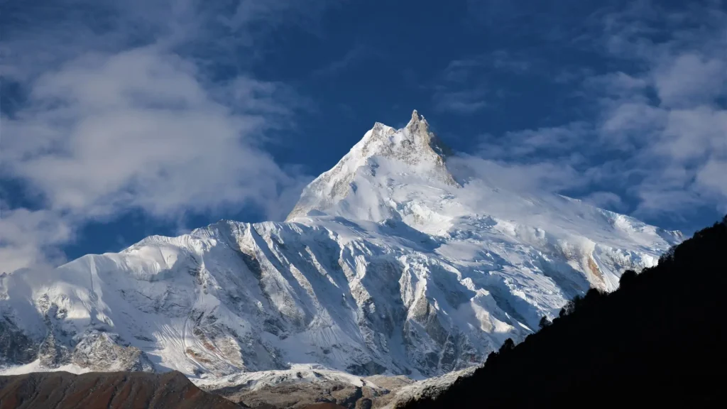
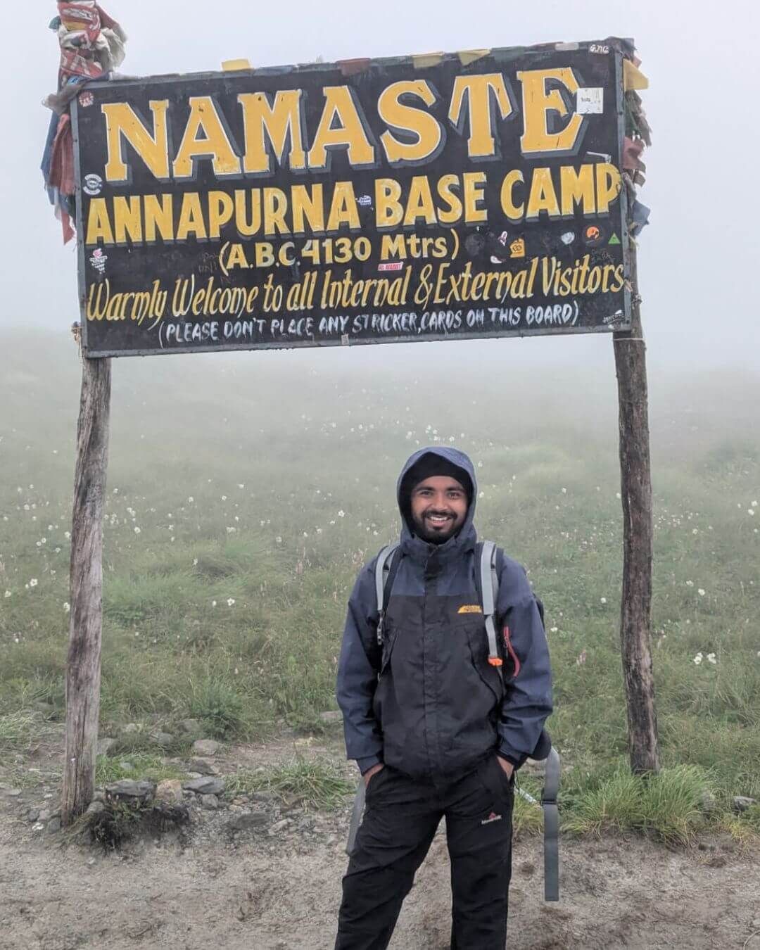
The Manaslu Region is a restricted trekking area in Gorkha district, Nepal, centered on 8,163 m Mount Manaslu. Its main draw is the Manaslu Circuit Trek, a 14-18 day, roughly 177 km teahouse trek through the Budhi Gandaki valley, over 5,106 m Larkya La Pass, with an optional detour into the sacred Tsum Valley. Autumn and spring are the best trekking seasons, and every foreign trekker needs a licensed guide and three permits (MCAP, RAP, and ACAP).
The Manaslu Region sits in the Gorkha district of west-central Nepal, wrapped around the world’s eighth-highest mountain, Mount Manaslu (8,163 m). Unlike Everest or Annapurna, this is a restricted area that only opened to foreign trekkers in 1991 (in organized groups with licensed guides), which is why its trails, monasteries, and Tibetan Buddhist villages still feel far less crowded than Nepal’s more famous circuits.
It is a restricted area. Every foreign trekker must trek with a licensed guide from a registered agency; a minimum group size of two foreign trekkers is legally required to obtain the Restricted Area Permit, and solo foreign trekking without a group and guide is not permitted.
Table of Contents
At a Glance
- 14 to 18 days, 150 to 177 km restricted-area trek around Mount Manaslu (8,163 m), crossing Larkya La Pass (5,106 m).
- Guide + minimum 2 trekkers required for the Restricted Area Permit. Solo trekking is not allowed.
- 3 permits needed: RAP, MCAP, and ACAP. No TIMS card required.
- Best seasons: autumn (September to November) and spring (March to May).
- Route: Machha Khola → Samagaon → Samdo → Larkya La → Bimthang → Dharapani, with optional Tsum Valley detour.
- Budget: roughly $1,200 to $2,000+ per person all-inclusive.
- Altitude sickness is the main risk. Acclimatization days are essential.
- Rich Tibetan Buddhist culture in Nubri and Tsum villages, quieter than Everest or Annapurna.
What Is the Manaslu Region, Nepal?
The Manaslu Region, Nepal, is the area of Gorkha district surrounding Mount Manaslu, protected since 1998 as the Manaslu Conservation Area (MCA). It covers 1,663 sq km and spans an extraordinary elevation range, from subtropical forest around 600-1,400 m near the Budhi Gandaki River up to the 8,163 m summit of Manaslu itself.
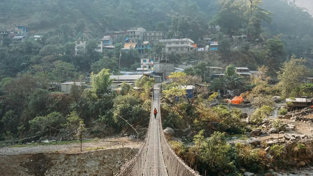
The region is managed by the National Trust for Nature Conservation (NTNC) through the Manaslu Conservation Area Project, working alongside local Conservation Area Management Committees. It was only the second conservation area in Nepal to come under NTNC management, after the neighboring Annapurna Conservation Area, which it borders to the west.
Geographically, the Manaslu Region divides into a few distinct zones:
- Lower Budhi Gandaki Valley (Machha Khola to Jagat): subtropical terraced farmland and Gurung and Magar villages.
- Nubri Valley (Namrung to Samagaon): Tibetan Buddhist villages, mani walls, and close-up Manaslu views.
- Upper valley (Samdo to Larkya La): high alpine terrain bordering Tibet.
- Tsum Valley: a sacred side valley branching north from Lokpa, historically an isolated Buddhist enclave.
| Quick Fact: Manaslu means “Mountain of the Spirit” in Sanskrit, derived from manasa (“intellect” or “soul”). Local Tibetan-origin communities also refer to the peak by its own traditional names tied to regional folklore. |
Why Visit the Manaslu Region?
The Manaslu Region appeals to travelers who want Himalayan scenery and genuine Tibetan Buddhist culture without the crowds of Everest Base Camp or the Annapurna Circuit. Because it has been a restricted area since it opened to trekkers in 1991, daily trekker numbers stay a fraction of those on Nepal’s most popular routes.
Three things set it apart:
- Culture that feels lived-in, not staged. Villages like Samagaon and Lho retain Tibetan-style architecture, working monasteries, and communities who still practice transhumance farming and yak herding, largely because tourism arrived here decades later than in the Khumbu or Annapurna.
- A genuine high-pass crossing. Larkya La (5,106 m) is comparable in difficulty and altitude to Everest Base Camp’s Kala Patthar viewpoint but is a through-pass rather than an out-and-back trek.
- Direct views of an 8,000 m peak from village level. Samagaon and Samdo sit close enough to Manaslu’s south face that no side excursion is needed to see it properly.
| Local Insight: Trekking agencies in Kathmandu often pitch Manaslu as “the trek Everest Base Camp used to be 20 years ago.” Teahouses are simpler, trails are quieter, and encounters with local life are more frequent, though this also means fewer amenities and a real need for proper preparation. |
Curious what else Nepal has to offer? Browse more trekking regions and destinations on our Nepal Destinations page.
Places to Visit in the Manaslu Region, Nepal
These are the essential stops most itineraries pass through, listed roughly south to north along the main circuit.
| Place | Elevation | Why Visit |
| Machha Khola | 869 m | Trailhead village, first overnight stop |
| Jagat | 1,340 m | First Restricted Area Permit checkpoint |
| Deng | 1,860 m | Entry into Tibetan-influenced Nubri villages |
| Namrung | 2,630 m | Best-preserved traditional architecture on the route |
| Lho | 3,180 m | Ribung Gompa monastery, first big Manaslu views |
| Samagaon (Sama Gaun) | 3,530 m | Largest Nubri village, acclimatization base, views of Manaslu’s south face |
| Samdo | 3,860 m | Last permanent village before the Tibet border |
| Dharamsala (Larkya Phedi) | 4,460 m | Final camp before Larkya La |
| Larkya La Pass | 5,106 m | Highest point of the trek, panoramic views of Manaslu, Himlung, Cheo, and Annapurna II |
| Bimthang | 3,720 m | First village on the descent, close-up Manaslu north-face views |
| Dharapani | 1,860 m | Trek’s endpoint connects into the Annapurna Circuit road |
Tsum Valley deserves its own mention as a worthwhile detour from Lokpa. It only opened to foreign trekkers in 2008 and is considered one of Nepal’s most spiritually significant valleys, home to Mu Gompa and Rachen Gompa monasteries and villages that still follow traditional Tibetan Buddhist customs closely tied to the nearby Ganesh Himal range.
Things to Do in the Manaslu Region
Beyond simply walking the circuit, there’s a range of ways to experience the region depending on time and interest.
- Trek the full Manaslu Circuit. This is the classic 14 to 18 day route from Machha Khola to Dharapani over Larkya La.
- Add the Tsum Valley extension. This adds 3 to 7 extra days exploring monasteries and villages largely untouched by mass tourism.
- Visit Ribung and Pungyen Gompa near Lho and Samagaon for insight into Nubri Buddhist practice.
- Day-hike above Samagaon to Manaslu Base Camp or Birendra Tal, a glacial lake beneath the mountain, as an acclimatization outing.
- Photograph the Budhi Gandaki gorge. The lower trail includes some of the most dramatic suspension-bridge and cliff-side sections of any trek in Nepal.
- Observe Losar celebrations if visiting in February, when Nubri and Tsum communities celebrate Tibetan New Year with masked dances and rituals.
| Photography Tip: The clearest south-face views of Manaslu are from the ridge above Samagaon in the early morning, before afternoon cloud typically builds up over the peak. |
When Is the Best Time to Visit the Manaslu Region?
Autumn (September to November) is the best time to visit the Manaslu Region, offering the most stable weather, clear skies, and reliable mountain visibility of any season. Spring (March to May) is a close second, adding blooming rhododendrons at lower elevations.
| Season | Conditions | Suitability |
| Autumn (Sep-Nov) | Stable, clear, cool | Best overall, peak season |
| Spring (Mar-May) | Warming rhododendron blooms | Excellent, slightly less crowded |
| Winter (Dec-Feb) | Cold, possible snow at Larkya La | Passable for experienced trekkers; the pass can close after heavy snowfall |
| Monsoon (Jun-Aug) | Heavy rain, leeches, limited visibility, landslide risk | Not recommended for the full circuit |
| Weather Tip: Larkya La is the trek’s main weather risk point. Even in good seasons, temperatures at Dharamsala and the pass itself commonly drop below freezing overnight, and an insulated down jacket plus a sleeping bag rated to at least -15°C is a realistic minimum, not an exaggeration. |
How to Get to the Manaslu Region
Most Manaslu treks begin from Kathmandu, since there’s no direct flight into the region.
- Drive from Kathmandu to Machha Khola or Soti Khola (the common trailheads). This takes roughly 7 to 9 hours by local bus or jeep, covering about 150 km via Arughat.
- Alternative: drive via Gorkha Bazaar, which shortens the trailhead approach for travelers starting from Pokhara.
- Exit at Dharapani, where the trail meets the Annapurna Circuit road, allowing a drive back to Kathmandu or onward to Pokhara via Besisahar. This typically takes 8 to 10 hours.
There is no airstrip inside the Manaslu Region itself, which is part of why it has stayed quieter than Everest (served by Lukla Airport) or Annapurna (accessible via Pokhara Airport).
| Safety Advice: Road conditions between Kathmandu and Soti Khola can be rough and occasionally landslide-affected during and just after monsoon; building a buffer day into your itinerary before the trek starts is worth it. |
Manaslu Circuit Trek: Difficulty and Altitude
The Manaslu Circuit is rated moderate to challenging, primarily because of the altitude gain over Larkya La Pass (5,106 m) rather than technical terrain. The trail itself involves no climbing gear or rope sections.
- Distance: approximately 150-177 km depending on the exact start/end points and route variations
- Duration: 14-18 days, including acclimatization days
- Highest point: Larkya La Pass, 5,106 m
- Daily walking time: 5-7 hours on most days, with a longer 8-9 hour day crossing the pass
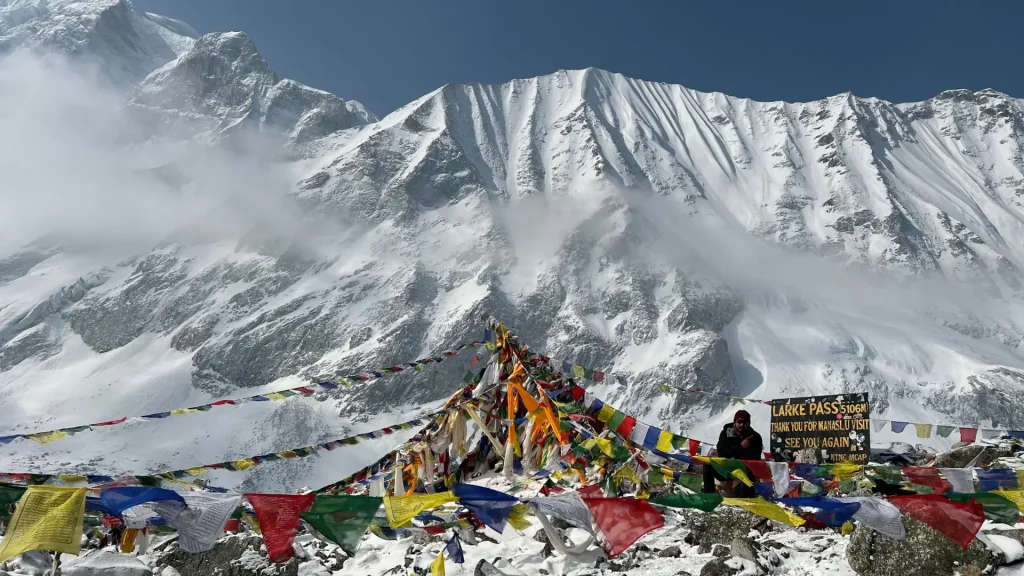
Altitude sickness is the primary risk. Trekkers gain significant elevation between Samagaon (3,530 m) and the pass, so most itineraries build in at least one acclimatization day at Samagaon or Samdo.
| Important: Do not attempt to cross Larkya La on the same day you arrive at Dharamsala from a lower elevation without acclimatization. This is one of the more common mistakes that leads to altitude-related evacuations on this route. |
Manaslu Region Permits
Trekking in the Manaslu Region requires three separate permits, and all must be arranged through a government-registered trekking agency. Independent, guideless trekking is not legally possible here.
| Permit | Purpose | Approx. Cost (2026) |
| Manaslu Restricted Area Permit (RAP) | Required beyond the Jagat checkpoint | USD 100/person for the first 7 days (Sep-Nov), USD 75/person for the first 7 days (Dec-Aug); additional per-day fee after that |
| Manaslu Conservation Area Permit (MCAP) | Entry into the conservation area | USD 30/person, flat rate year-round |
| Annapurna Conservation Area Permit (ACAP) | Trail exits into Annapurna territory near Dharapani | Included as part of standard trekking arrangements |
| Tsum Valley Permit (if visiting) | Separate restricted area north of the main circuit | Additional seasonal fee, roughly USD 30-40/person for the first week |
| Permit Requirements: Nepal’s Department of Immigration maintains a strict minimum requirement of at least two foreign trekkers traveling together to issue a Restricted Area Permit (RAP). A licensed guide from a registered agency remains mandatory in every restricted area, including Manaslu and Tsum Valley. TIMS cards are not required for the Manaslu Circuit. |
The RAP can only be issued through an authorized trekking agency registered with the Trekking Agencies’ Association of Nepal (TAAN); the MCAP and ACAP can also be obtained directly from Nepal Tourism Board offices in Kathmandu or Pokhara, though most trekkers let their agency handle all three together.
Cost of Trekking in the Manaslu Region
A realistic all-inclusive budget for the Manaslu Circuit Trek runs from roughly USD 1,200 to USD 2,000+ per person, depending on season, group size, and whether you book independently through a local agency or an international operator.
Main cost components:
- Permits (RAP + MCAP + ACAP): roughly USD 135-200 for a standard 14-day itinerary, more in peak autumn season
- Guide: approximately USD 25-35 per day
- Porter (optional): approximately USD 20-25 per day
- Teahouse lodging and meals: roughly USD 25-35 per day, higher than Everest or Annapurna since supplies are carried further and in smaller volume
- Transport to/from trailhead: USD 15-40 each way depending on bus, jeep, or private vehicle
| Budget Tip: Because teahouses along the Manaslu route have less competition than on the Everest or Annapurna trails, meal and room prices are often less negotiable. Budgeting slightly more per day for food than you would elsewhere in Nepal is realistic. |
Accommodation in the Manaslu Region
Teahouse lodges are available at all the main overnight stops along the Manaslu Circuit, though they are generally more basic than those on the Everest or Annapurna trails. Expect simple twin rooms with shared bathrooms at lower elevations and more basic stone or wood lodges with squat toilets and limited hot-water access above Samagaon.
- Lower valley (Machha Khola-Namrung): decent teahouses, some with attached bathrooms
- Nubri villages (Lho-Samdo): simpler lodges, Tibetan-style stone construction, communal dining rooms heated by a central stove
- Dharamsala/Larkya Phedi: the most basic lodging on the route, functioning mainly as a staging point before the pass crossing
- Bimthang and beyond: teahouses improve again on the Annapurna-side descent
| Packing Tip: A good sleeping bag liner and your own basic toiletries are worth carrying, since amenities thin out considerably above Samagaon compared to what’s typically stocked on the Everest or Annapurna routes. |
Food in the Manaslu Region
Teahouse menus follow the standard Nepal trekking staples, including dal bhat, noodle soups, momos, and fried rice, supplemented in Nubri and Tsum villages by Tibetan-influenced dishes like thukpa (noodle soup) and tsampa (roasted barley flour, often mixed into porridge or butter tea).
Dal bhat (lentils, rice, and vegetable curry) is the most practical staple for trekkers, since most teahouses offer free refills, which matters on long trekking days at altitude. Butter tea, common in Samagaon and Samdo, is a distinctly local option worth trying, made with yak butter and salt rather than sugar.
Culture of the Manaslu Region
The Manaslu Region is home to a mix of Gurung communities in the lower valley and Tibetan-origin communities (often referred to locally as Nubri and Tsum people) in the upper valley and Tsum Valley, whose language, dress, and religious practice closely mirror Tibetan Buddhist tradition.
Villages like Lho, Samagaon, and Samdo are built around gompas (monasteries), chortens, and long mani walls inscribed with Buddhist prayers. Trekking etiquette calls for passing these structures on the left, in a clockwise direction, consistent with Tibetan Buddhist custom.
Tsum Valley in particular has a documented history as a sacred hidden valley (beyul) in Tibetan Buddhist tradition, and its communities historically practiced non-violence toward animals, including a longstanding local ban on hunting and animal slaughter within the valley.
| Quick Fact: The Manaslu Region’s population is relatively small and concentrated in a handful of villages along the Budhi Gandaki, which is part of why community-based tourism initiatives here, including homestays, local guide training, and conservation fees reinvested locally, have had a visible impact on daily life in Nubri and Tsum. |
Manaslu Circuit Trek Itinerary (Sample, 15 Days)
| Day | Route | Elevation |
| 1 | Kathmandu to Machha Khola | 869 m |
| 2 | Machha Khola to Jagat | 1,340 m |
| 3 | Jagat to Deng | 1,860 m |
| 4 | Deng to Namrung | 2,630 m |
| 5 | Namrung to Lho | 3,180 m |
| 6 | Lho to Samagaon | 3,530 m |
| 7 | Acclimatization day in Samagaon | 3,530 m |
| 8 | Samagaon to Samdo | 3,860 m |
| 9 | Acclimatization/side hike from Samdo | 3,860 m |
| 10 | Samdo to Dharamsala (Larkya Phedi) | 4,460 m |
| 11 | Dharamsala over Larkya La to Bimthang | 3,720 m |
| 12 | Bimthang to Dharapani | 1,860 m |
| 13 | Dharapani to Besisahar/Kathmandu by road | — |
| 14-15 | Buffer days for weather or altitude delays | — |
Travelers with extra time commonly extend this itinerary by 3-7 days to include the Tsum Valley detour from Lokpa before continuing north toward Samagaon.
Common Mistakes to Avoid During the Manaslu Region
- Skipping acclimatization days: The jump from Samagaon to Samdo to Dharamsala gains significant altitude quickly; cutting these days short is a leading cause of altitude sickness on this route.
- Underestimating teahouse basicness above Samagaon: Some travelers expect Everest-level infrastructure and are caught off guard by simpler facilities.
- Not budgeting enough cash: There are no ATMs beyond the lower valley, so all cash for permits, lodging, and food must be carried from Kathmandu or Gorkha.
- Assuming TIMS cards are required: They are not needed for the Manaslu Circuit as of the current permit system, and agencies quoting this fee separately are adding an unnecessary cost.
- Booking a guideless trip: This is not legally possible in a restricted area; any agency offering a “guideless Manaslu trek” is not operating within current regulations.
| Pro Tip: Build in at least one flexible buffer day near the end of the itinerary. Larkya La can occasionally be affected by weather delays, and having a spare day prevents a rushed descent or a missed onward flight from Kathmandu. |
Final Thoughts
The Manaslu Region offers one of Nepal’s most rewarding combinations of high-altitude trekking and authentic Tibetan Buddhist culture, centered on the dramatic backdrop of Mount Manaslu itself.
Whether you’re drawn by the challenge of crossing Larkya La Pass, the quieter trails compared to Everest and Annapurna, or the chance to explore the sacred Tsum Valley, planning around the right season, permits, and a licensed guide will make the difference between a smooth trip and a difficult one.
If you’re ready to start planning, the next step is settling on your season and itinerary length, then booking your permits through a registered trekking agency well ahead of your travel dates.
Ready to start planning your trek? Visit Wander Himalayan for expert guides, itineraries, and everything you need to explore the Himalayas.
Frequently Asked Questions
1. Where is the Manaslu Region located?
The Manaslu Region is located in Gorkha district, west-central Nepal, roughly 140 km northwest of Kathmandu, bordered by Tibet to the north and the Annapurna Conservation Area to the west.
2. How difficult is the Manaslu Circuit Trek?
The Manaslu Circuit Trek is rated moderate to challenging, mainly due to the altitude gain over Larkya La Pass (5,106 m) rather than technical difficulty, and it is best suited to trekkers with some prior high-altitude hiking experience.
3. How many days does the Manaslu Circuit Trek take?
The Manaslu Circuit Trek typically takes 14 to 18 days, including acclimatization days, depending on whether you add the Tsum Valley extension or extra rest days.
4. Do I need a permit for the Manaslu Region?
Yes, the Manaslu Region requires three permits: the Manaslu Restricted Area Permit (RAP), the Manaslu Conservation Area Permit (MCAP), and the Annapurna Conservation Area Permit (ACAP), all arranged through a registered trekking agency.
5. Can I trek the Manaslu Circuit solo?
No, you cannot trek the Manaslu Circuit solo. Under Nepal’s Department of Immigration regulations, obtaining a Restricted Area Permit (RAP) requires a minimum group size of two foreign trekkers traveling with a licensed guide from a registered trekking agency. Fully independent or single-person foreign trekking is not permitted in this restricted area.
6. What is the best time to visit the Manaslu Region?
Autumn (September to November) is the best time to visit the Manaslu Region, followed closely by spring (March to May), thanks to stable weather and clear mountain visibility in both seasons.
7. How much does the Manaslu Circuit Trek cost?
The Manaslu Circuit Trek generally costs between USD 1,200 and USD 2,000 or more per person, covering permits, a licensed guide, teahouse lodging, meals, and transport to and from the trailhead.
8. Is the Manaslu Circuit harder than Everest Base Camp?
The Manaslu Circuit is comparable in difficulty to Everest Base Camp, with a higher maximum altitude at Larkya La (5,106 m) than Kala Patthar’s typical viewpoint elevation, but a longer overall trail distance and more basic teahouse infrastructure.
9. What is Tsum Valley, and is it part of the Manaslu Region?
Tsum Valley is a sacred side valley within the Manaslu Region, branching north from Lokpa on the main circuit, known for its Tibetan Buddhist monasteries and opened to foreign trekkers only in 2008.
10. How do I get to the Manaslu Region from Kathmandu?
You reach the Manaslu Region by road from Kathmandu to Machha Khola or Soti Khola, a drive of roughly 7 to 9 hours, since there is no airstrip serving the region directly.
11. What is the highest point on the Manaslu Circuit Trek?
The highest point on the Manaslu Circuit Trek is Larkya La Pass at 5,106 meters, which connects the Budhi Gandaki valley to the Marshyangdi valley on the Annapurna side.
12. Do I need travel insurance for the Manaslu Region?
Yes, comprehensive travel insurance covering high-altitude trekking and emergency helicopter evacuation up to at least 6,000 m is strongly recommended, given the remoteness of the route and limited medical access above Samagaon.
Sources
- Manaslu Conservation Area, Wikipedia (citing NTNC/DNPWC data): https://en.wikipedia.org/wiki/Manaslu_Conservation_Area
- National Trust for Nature Conservation, Manaslu Conservation Area Project: https://ntnc.org.np
- Department of Immigration, Government of Nepal, restricted area regulations: https://www.immigration.gov.np
- Nepal Tourism Board, conservation area permits: https://ntb.gov.np