
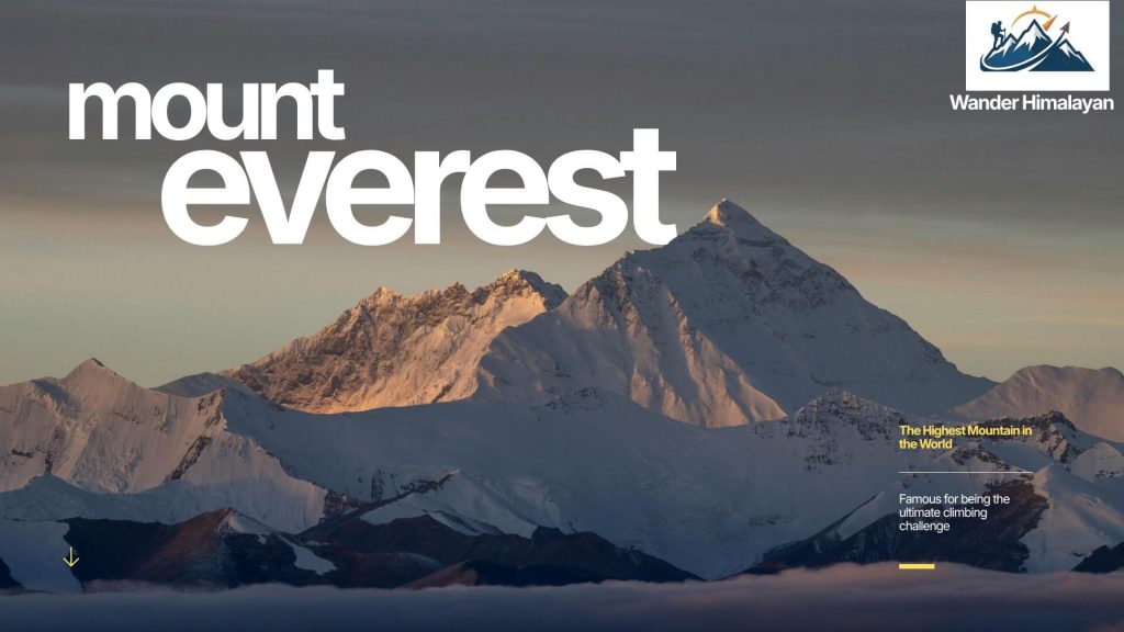
The Everest Region, also called the Mount Everest Region or Khumbu, is a mountainous district in northeastern Nepal that is home to Mount Everest, the Sherpa people, and some of the most famous trekking routes on Earth. It sits inside Sagarmatha National Park, a UNESCO World Heritage Site, and is reached by a short mountain flight from Kathmandu to Lukla, followed by several days of trekking through Sherpa villages, Buddhist monasteries, and high-altitude landscapes.
Most travelers visit the Everest Region to trek toward Everest Base Camp, but the region also offers shorter treks, cultural stops, and viewpoints for people who don’t want to go all the way to Base Camp.
This Everest Region travel guide covers everything you need to know before visiting the Everest Region, Nepal, including trekking routes, permits, weather, and cultural highlights. Whether you’re planning a short trek or a full expedition through the Mount Everest region, this guide helps you explore the best experiences across the Mt Everest region with confidence.
Table of Contents
Quick Facts About the Everest Region
- Location: Solukhumbu District, northeastern Nepal
- Nearest airport: Lukla (Tenzing-Hillary Airport), reached by a 25–30 minute flight from Kathmandu
- Main ethnic group: Sherpa (Tibetan Buddhist)
- Protected area: Sagarmatha National Park (UNESCO World Heritage Site since 1979)
- Highest point on standard trek: Kala Patthar, 5,545 m
- Everest Base Camp elevation: 5,364 m
- Best seasons: March–May (spring) and September-November (autumn)
- Typical trip length: 5 days (Everest View Trek) to 12–18 days (Everest Base Camp or Three Passes)
- Permits required: Sagarmatha National Park entry permit + Khumbu Pasang Lhamu Rural Municipality entry permit
Where Is the Everest Region?
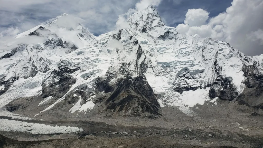
The Everest Region sits in the Solukhumbu district of Koshi Province, close to the Nepal-Tibet border. It’s centered on the Khumbu Valley, carved out by glacial rivers flowing down from Everest, Lhotse, Nuptse, and Ama Dablam. Most trekkers enter through Lukla, then follow the Dudh Koshi River valley north toward Namche Bazaar, the region’s main trading town and unofficial capital.
Because the region sits almost entirely above 2,800 meters, altitude is a factor everywhere you go here; even the ‘easy’ walks require basic acclimatization awareness.
How to Get to the Everest Region
There is no road access to the core Everest Region, so almost everyone arrives by a short mountain flight or a multi-day overland trek. The two options are
- Flight to Lukla: Kathmandu to Lukla is a 25-30 minute scenic flight, widely considered one of the most dramatic short flights in the world. Flights are frequently delayed or rerouted through Ramechhap during peak season due to weather and air traffic.
- The classic overland route (Jiri to Lukla): The original approach used before the Lukla airstrip opened. It adds 6–8 extra trekking days but avoids flight uncertainty and passes through lower-altitude Sherpa and Rai villages most visitors never see.
There is no direct road, jeep, or bus route all the way into the Khumbu; vehicles stop at Jiri or Salleri, well short of Lukla.
What Is the Best Time to Visit the Everest Region?
The best time to visit Everest Region is late September through November, when weather is most stable and mountain views are clearest, with March through May as a close second choice.
| Season | Months | Conditions |
| Spring | March–May | Warmer days, rhododendrons in bloom, clearest mountain views by late spring, busiest season alongside autumn |
| Summer/Monsoon | June–August | Heavy rain, leeches on lower trails, frequent flight delays, cloud cover blocks mountain views |
| Autumn | September–November | Most stable weather of the year, clearest skies, peak trekking season |
| Winter | December–February | It’s very cold at altitude, some teahouses are closed, there are fewer crowds, and clear (but freezing) views are possible on shorter treks. |
In short: if you can only pick one window, late September through November gives the most reliable weather and mountain visibility. Spring is a close second and better if you want to see rhododendron blooms.
What Are the Top Things to Do in the Everest Region?
The top things to do in the Everest region are visiting Namche Bazaar, Tengboche Monastery, Everest Base Camp, Kala Patthar, and Gokyo Lakes.
1. Namche Bazaar
The trading and cultural hub of the Khumbu, sitting at 3,440 m in a natural amphitheater of the mountains. Most itineraries build in a rest day here for acclimatization, which also gives time to explore its bakeries, gear shops, and the Sherpa Culture Museum.
2. Tengboche Monastery
The most important Buddhist monastery in the Khumbu, set on a ridge at 3,860 m with direct views of Everest, Lhotse, and Ama Dablam. Visitors can watch daily prayer ceremonies, and the monastery hosts the Mani Rimdu festival each autumn.
3. Everest Base Camp
The endpoint of the region’s most iconic trek, sitting at the foot of the Khumbu Icefall. The camp itself is a rocky, glacier-covered site with no permanent mountain views of Everest, most trekkers get their best photo of Everest from nearby Kala Patthar instead.
4. Kala Patthar
A viewpoint at 5,545 m offering the closest unobstructed view of Everest’s summit available without technical climbing gear. Most base camp trekkers hike here at sunrise.
5. Gokyo Lakes
A series of turquoise glacial lakes on a quieter route than the main Base Camp trail, reached by crossing the Cho La pass or via a separate valley from Namche. Gokyo Ri offers views of four 8,000-meter peaks from one summit.
6. Sagarmatha National Park
The UNESCO-protected area covers most of the region, home to Himalayan tahr, musk deer, and (rarely sighted) snow leopards, alongside old-growth birch, fir, and rhododendron forests at lower elevations.
What Are the Trekking Routes in the Everest Region?
The Everest Region has five main trekking routes, ranging from the easy 5-day Everest View Trek to the demanding 18–21-day Three Passes Trek.
| Route | Duration | Max Altitude | Difficulty |
| Everest View Trek | 5–7 days | ~3,880 m (Everest View Hotel/Khumjung) | Easy |
| Everest Base Camp Trek | 12–14 days | 5,545 m (Kala Patthar) | Moderate–Challenging |
| Gokyo Lakes Trek | 12–14 days | 5,357 m (Gokyo Ri) | Moderate–Challenging |
| Everest Three Passes Trek | 18–21 days | 5,535 m (Kongma La) | Challenging |
| Everest Base Camp + Gokyo Combined | 16–18 days | 5,545 m | Challenging |
The Everest Base Camp Trek is by far the most popular route and the best starting point for most first-time Himalayan trekkers who want the full experience without needing technical climbing skills.
Continue Exploring the Himalayas
The Everest Region is just one of Nepal’s incredible trekking destinations. From the Annapurna Circuit to Langtang Valley and Manaslu, our travel guides cover everything you need to compare routes, understand permits, and prepare for your journey.
Read more destination guides on Wander Himalayan and plan your perfect Himalayan itinerary.
What Is the Everest Base Camp Elevation?
Everest Base Camp on the south-southeast side of Nepal sits at 5,364 meters (17,598 feet) above sea level, at the foot of the Khumbu Icefall. This is the base camp reached by the standard Everest Base Camp trek and the one most travelers mean when searching for “Everest Base Camp.”
There is a second, separate North Base Camp on the Tibet side of the mountain, sitting at roughly 5,150 meters (16,900 feet), reached by vehicle rather than on foot. It’s used by expeditions climbing Everest’s north face and is not part of the standard Nepal trekking routes covered in this guide.
Neither base camp offers a full view of Everest’s summit, for that, trekkers on the Nepal side continue to Kala Patthar (5,545 m), a separate viewpoint above base camp.
What Is Rainbow Valley on Everest?
Rainbow Valley is the nickname used by mountaineers for a stretch of Everest’s Northeast Ridge, above 8,000 meters, within the Death Zone on the mountain’s Tibet (north) side climbing route. The name refers to the brightly colored jackets and gear of climbers who have died attempting the summit and whose remains are extremely difficult to recover at that altitude, making them a visible marker along the route for later climbers.
This area has no connection to the standard Everest Region trekking routes covered in this guide. It sits thousands of meters above Everest Base Camp, well beyond where any trekker, as opposed to a summit-permit mountaineer, would ever travel. Visitors doing the Everest Base Camp Trek, Gokyo Lakes Trek, or any other standard route in this region will not see it and are in no way exposed to the risks associated with it.
What Permits Do You Need for the Everest Region?
Two Everest Region permits are required for all standard treks: the Sagarmatha National Park Entry Permit and the Khumbu Pasang Lhamu Rural Municipality Entry Permit. Understanding these Everest Region permits before your trip will help you avoid delays at checkpoints and ensure a smooth trekking experience.
- Sagarmatha National Park Entry Permit: required for entering the national park itself.
- Khumbu Pasang Lhamu Rural Municipality Entry Permit: A local area permit that replaced the old TIMS card requirement for this specific region.
Both are available in Kathmandu or at the park entrance near Monjo, on the trail itself. Independent trekkers do not need a licensed guide by law in the Everest Region (unlike restricted areas such as Upper Mustang or Manaslu), though many choose to hire one for safety, navigation, and to support the local economy.
Sherpa Culture in the Everest Region
The Everest Region is the traditional homeland of the Sherpa people, Tibetan Buddhists who migrated into the Khumbu roughly 500 years ago. Their culture is visible throughout the trek: prayer flags strung across suspension bridges, mani walls and chortens along the trail (always passed on the left, per local custom), and monasteries like Tengboche that anchor daily religious life.
Sherpas are also internationally known as expert high-altitude mountaineers, and many families in Namche and surrounding villages have generations of Everest summit and guiding experience. Teahouse lodges throughout the region are almost entirely Sherpa-owned and run, which means trekking here also means staying within, and directly supporting, this community.
Where to Stay in the Everest Region
Accommodation is almost entirely in teahouses, small, family-run lodges offering basic private rooms (usually twin beds and shared bathrooms at lower-cost lodges) and a communal dining room. Standards improve in Namche and Lukla, where some lodges offer attached bathrooms and hot showers, while higher villages like Lobuche and Gorak Shep have simpler, more basic facilities. Advance booking isn’t usually necessary except in the busiest weeks of peak season.
What Food Is Available in the Everest Region?
Dal bhat (lentils, rice, and vegetable curry) is the standard trekking meal, offered with free refills at most teahouses and a reliable source of energy for long trekking days. Other common options include noodle soups, momos, and Tibetan bread, along with garlic soup, which is widely believed by trekkers (though not medically proven) to help with acclimatization.
What to Pack for the Everest Region
Layering is essential, since temperatures can shift from warm midday sun to well below freezing at night, even in the milder months. A proper down jacket, insulated sleeping bag, sturdy broken-in trekking boots, and trekking poles are considered essential rather than optional at these altitudes.
What Is the Altitude Sickness Risk in the Everest Region?
Altitude sickness is a real risk on every standard route in the Everest Region, not just the Base Camp trek, because most of the region sits above 3,000 meters. Standard itineraries build in acclimatization days at Namche Bazaar and Dingboche for this reason, and the golden rule for prevention is to avoid ascending more than 300–500 meters in sleeping altitude per day above 3,000 meters.
Everest Region Trip Cost
A standard 12–14 day Everest Base Camp Trek costs roughly $450 to $1,700 per person, depending on whether you go budget, mid-range, or fully organized.
| Budget Level | Daily Cost | Total (12–14 days) |
| Budget/backpacker | $30–40/day | $450–600 |
| Mid-range (guide + porter) | $50–70/day | $700–1,000 |
| Fully organized package | $80–120/day | $1,200–1,700 |
This excludes the Kathmandu–Lukla flight (roughly $340-400 round trip) and permits (roughly $30-40 total), both of which should be budgeted separately.
Everest Region FAQs
Is the Everest Region the same as Everest Base Camp?
No. The Everest Region (Khumbu) is the entire geographic area, including Namche Bazaar, Tengboche, Gokyo, and several trekking routes. Everest Base Camp is one specific destination within that region, reached via one specific trekking route.
How many days do I need for the Everest Region?
A short cultural/viewpoint trip (Everest View Trek) takes 5–7 days. The full Everest Base Camp Trek takes 12–14 days. The Three Passes Trek, which covers the whole region, takes 18–21 days.
Do I need a guide for the Everest Region?
No, it is not legally required for standard routes like Everest Base Camp or Gokyo Lakes, unlike restricted areas such as Upper Mustang or Manaslu. Many trekkers still choose to hire one for safety and local support.
How do I get to the Everest Region from Kathmandu?
Almost all visitors fly from Kathmandu to Lukla, a 25–30 minute flight. An overland alternative starts with a drive to Jiri or Salleri, followed by 6–8 additional trekking days to reach Lukla on foot.
Is the Everest Region safe for beginners?
Shorter routes like the Everest View Trek are beginner-friendly. The full Everest Base Camp Trek is achievable for reasonably fit beginners with no technical climbing experience, provided they follow proper acclimatization pacing.
What is the Everest Region called?
It’s commonly called Khumbu, or the Khumbu region. “Everest Region” and “Khumbu” are used interchangeably by trekkers, guides, and tourism boards.
What is the Khumbu region?
The Khumbu region is the area of northeastern Nepal surrounding Mount Everest, home to the Sherpa people, Sagarmatha National Park, and the main trekking routes to Everest Base Camp, Gokyo Lakes, and the Three Passes. It’s the local and more traditional name for what’s widely marketed to travelers as the “Everest Region.”
What is the nickname of Everest?
In Nepali, Everest is called Sagarmatha, meaning “Forehead of the Sky.” In Tibetan, it’s called Chomolungma, meaning “Goddess Mother of the World.” Both names are used officially alongside “Everest” in Nepal.
What is Everest Base Camp’s elevation?
Everest Base Camp on the Nepal side sits at 5,364 meters (17,598 feet). A separate North Base Camp on the Tibet side sits at approximately 5,150 meters (16,900 feet).
Is the Everest Region officially promoted by the Nepal Tourism Board?
Yes. The Everest Region is one of Nepal’s premier tourism destinations and is officially promoted by the Nepal Tourism Board (NTB) as a leading trekking and adventure destination. Visitors can use the Nepal Tourism Board’s official resources to find up-to-date travel information, trekking safety guidelines, festivals, and destination insights before planning their trip