
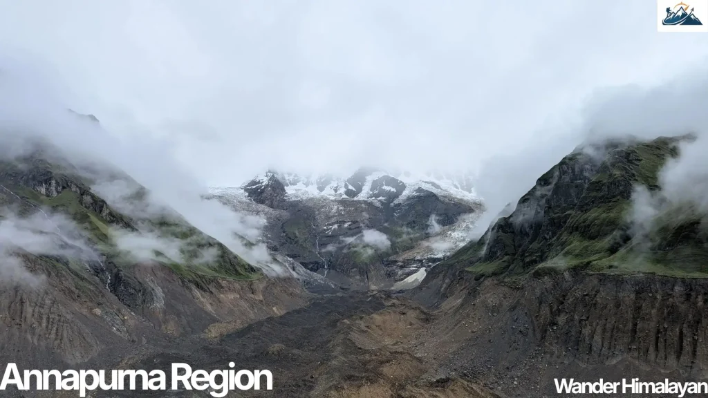
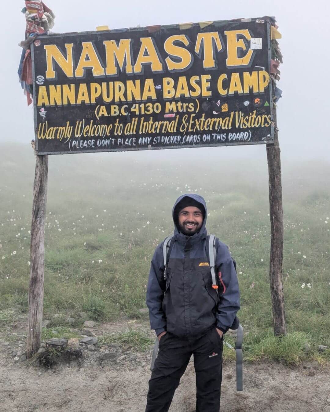
The Annapurna region is Nepal’s most-visited trekking and travel destination, drawing roughly 508,476 foreign tourists from 169 countries in a fiscal year 2025/2026 to a landscape that ranges from subtropical rice terraces at 800 meters to the icy summit of Annapurna I at 8,091 meters.
This guide covers everything you need to plan a trip: where the region is, when to go, which villages and treks to prioritize, what permits you need, how much it costs, and how to stay safe at altitude. Whether you have four days for Poon Hill or three weeks for the full Annapurna Circuit, this guide will help you build a trip that matches your time, budget, and fitness level.
At Wander Himalayan, we provide practical Nepal travel guides, trekking resources, and local insights to help you confidently explore the Annapurna region of Nepal.
Quick Answer
The Annapurna region of Nepal is a mountainous area in north-central Nepal centered on the Annapurna massif, protected within the 7,629 km² Annapurna Conservation Area (ACAP). It’s reached via Pokhara, Nepal’s second-largest city, and offers everything from short day hikes to multi-week treks like the Annapurna Circuit and Annapurna Base Camp. The best months to visit are October–November and March–April. A single ACAP permit (NPR 3,000 for foreigners) covers entry to nearly every trail in the region.
Annapurna Region at a Glance
- Located in Gandaki Province, about 200 km northwest of Kathmandu, with Pokhara as the main gateway.
- Protected within the Annapurna Conservation Area (ACA), Nepal’s largest protected area.
- ACAP is the required permit for most trekking routes; TIMS is no longer required.
- Best trekking seasons are October–November and March–April.
- Popular treks include the Annapurna Circuit, Annapurna Base Camp, Mardi Himal, and Ghorepani–Poon Hill.
- Accommodation is available in teahouses, making multi-day trekking accessible.
- A licensed guide is mandatory for most treks in the Annapurna region.
Table of Contents
What Is the Annapurna Region?
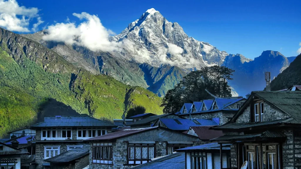
The Annapurna region is the area of north-central Nepal surrounding the Annapurna Himal, a massif of peaks that includes Annapurna I (8,091 m), the 10th-highest mountain on Earth and the first eight-thousander ever summited, in 1950. The massif also includes Annapurna II (7,937 m), Annapurna III (7,555 m), Annapurna IV (7,525 m), Annapurna South (7,219 m), Gangapurna (7,455 m), and the striking, unclimbed Machhapuchhre, or “Fishtail” (6,993 m), which is sacred to local communities and closed to climbers.
What sets the Annapurna region of Nepal apart from Nepal’s other trekking areas is its accessibility combined with its variety. Within a single trekking circuit, you pass through subtropical forest, terraced farmland, pine and rhododendron forest, high alpine desert, and glacial terrain, a range of ecosystems that few other trekking regions in the world offer in one trip. The entire region is protected within the Annapurna Conservation Area, which spans elevations from about 760 m to 8,091 m.
| Quick Fact: The Annapurna Conservation Area is Nepal’s first and largest protected area, covering 7,629 square kilometers, roughly the size of Puerto Rico. |
Where Is the Annapurna Region Located?
The Annapurna region is located in Gandaki Province in north-central Nepal, centered roughly 200 km northwest of Kathmandu and directly north of Pokhara, the region’s main gateway city. The Annapurna massif forms a horseshoe-shaped range around the Kali Gandaki River gorge, considered the deepest gorge on Earth relative to the height of the peaks flanking it.
Most travelers reach the region by first flying or driving to Pokhara (about 800 m elevation), then continuing by road or on foot into the hills. Districts covered by the Annapurna Conservation Area include Kaski, Manang, Mustang, Lamjung, and Myagdi.
Annapurna Conservation Area (ACAP): What It Is and Why It Matters
The Annapurna Conservation Area Project (ACAP) is the management body responsible for protecting the region’s biodiversity, regulating tourism, and supporting community-based conservation. Established in 1986 and run by the National Trust for Nature Conservation (NTNC), it was Nepal’s first protected area to combine conservation with direct community involvement, and it remains a widely studied model for community-based conservation elsewhere in the world.
Nearly every trekking route in the Annapurna region, including Annapurna Base Camp, the Annapurna Circuit, Mardi Himal, Ghorepani–Poon Hill, and Khopra Ridge, passes through ACA territory, which means every trekker on these routes needs a valid ACAP permit.
The conservation area is also home to significant biodiversity, including snow leopards, Himalayan black bears, musk deer, and over 100 species of mammals and birds recorded across its elevation range.
Best Time to Visit the Annapurna Region
The best time to visit the Annapurna region is October to November or March to April, when skies are clearest and temperatures are moderate at most trekking elevations. Each season offers a distinctly different experience, so the right time for you depends on what you want to prioritize, mountain views, fewer crowds, or flowering rhododendron forests.
| Season | Months | Conditions | Best For |
| Autumn (peak season) | Oct–Nov | Clear skies, stable weather, cool temperatures | Best mountain visibility, festivals (Dashain, Tihar) |
| Spring | Mar–Apr | Warmer days, rhododendrons blooming, some haze | Poon Hill, flowering forests, slightly fewer crowds than in autumn |
| Winter | Dec–Feb | Cold, especially above 3,000 m; clear mornings | Lower-elevation routes (Ghorepani, Ghandruk), quiet trails |
| Monsoon | Jun–Sep | Heavy rain, leeches at lower elevation, cloud cover | Mustang’s rain-shadow trails (Jomsom, Kagbeni), botanists |
| Weather Tip: The Mustang side of the Annapurna region, including Jomsom, Kagbeni, and Muktinath, sits in a rain shadow behind the Annapurna and Dhaulagiri massifs. It receives far less monsoon rainfall than the southern approach through Ghandruk or Chomrong, which makes it one of the few trekking areas in Nepal that remains viable in July and August. |
Important: Winter (December–February) brings heavy snowfall at Thorong La Pass (5,416 m), and the pass frequently closes for days at a time during storms. If you’re planning the full Annapurna Circuit in winter, build flexibility into your schedule and check current conditions with a local operator before committing to a crossing date.
Places to Visit in the Annapurna Region
The Annapurna region Nepal isn’t a single trail. It is a network of valleys, each with its own villages, culture, and scenery. Below are the destinations that come up most often in trip planning, whether you are trekking through or visiting as a shorter side trip from Pokhara.
1. Ghandruk
Ghandruk is a large Gurung village at about 1,940 m, roughly a half-day’s drive and walk from Pokhara, known for its stone-paved streets, traditional Gurung architecture, and unobstructed views of Annapurna South, Hiunchuli, and Machhapuchhre. It’s one of the most accessible villages in the region and works well as a short 2–3 day trip for travelers who don’t have time for a longer trek.
2. Ghorepani and Poon Hill
Ghorepani is a ridge-top village at about 2,860 m that serves as the base for the sunrise hike to Poon Hill (3,210 m), one of the most famous viewpoints in Nepal. From Poon Hill, on a clear morning, you can see a panorama that includes Dhaulagiri, Annapurna South, Annapurna I, Machhapuchhre, and Nilgiri.
| Pro Tip: Poon Hill gets crowded during peak autumn season, with dozens of trekkers arriving before sunrise. Leaving Ghorepani 10 to 15 minutes earlier than your guide suggests, or choosing the shoulder months of late October or early April, gets you a quieter spot on the viewing platform. |
3. Jomsom
Jomsom (2,720 m) is the administrative center of the Mustang district and a common turnaround or transit point for trekkers heading toward Muktinath or flying back to Pokhara. It sits in the Kali Gandaki Gorge and is known for strong afternoon winds that funnel up the valley almost daily. Mornings are calmer for walking.
4. Marpha
Marpha (2,670 m) is a Thakali village celebrated for its whitewashed stone houses, apple orchards, and locally distilled apple brandy. Many trekkers consider it one of the most photogenic villages on the entire Annapurna Circuit.
Photography Tip: Marpha’s flat-roofed, whitewashed houses are built close together to block wind. The narrow alleys between them create strong light-and-shadow contrast in the late afternoon, which is a better time to photograph the village than midday.
5. Kagbeni
Kagbeni (2,800 m) marks the gateway to Upper Mustang, a restricted area requiring a separate, higher-cost permit. Even without continuing into Upper Mustang, Kagbeni itself is worth a visit for its medieval-looking alleyways, red cliffs, and 15th-century monastery.
6. Muktinath
Muktinath (3,800 m) is one of the holiest pilgrimage sites in both Hinduism and Buddhism, home to a temple complex with 108 water spouts that pilgrims traditionally bathe under. For trekkers doing the Annapurna Circuit, Muktinath is the first major stop after crossing Thorong La Pass, and it’s reachable by road as well as on foot, which makes it accessible to non-trekking pilgrims and visitors too.
7. Tilicho Lake
Tilicho Lake (4,919 m) is one of the highest lakes in the world and a popular side trip from Manang on the Annapurna Circuit. The lake sits below Tilicho Peak (7,134 m) in a stark, high-altitude basin; reaching it typically adds 2–3 days to a circuit itinerary.
| Important: The trail to Tilicho Lake crosses an exposed, landslide-prone slope above Tilicho Base Camp. It is best attempted early in the morning before wind and rockfall risk increase later in the day, and it should not be attempted in poor visibility. |
Still deciding where to travel in Nepal? Browse our Nepal Destinations page to compare the country’s top trekking regions, wildlife parks, historic cities, and scenic landscapes before planning your itinerary.
Annapurna Trekking Routes
The Annapurna region offers several well-established trekking routes, each suited to different timeframes and fitness levels. All of them fall within the Annapurna Conservation Area and require an ACAP permit.
| Trek | Typical Duration | Max Altitude | Difficulty | Best For |
| Ghorepani–Poon Hill Trek | 4–5 days | 3,210 m (Poon Hill) | Easy–Moderate | First-time trekkers, short trips, mountain views without high altitude |
| Mardi Himal Trek | 5–6 days | 4,500 m (Mardi Himal Base Camp) | Moderate | Quieter trails, close-up Machhapuchhre views |
| Annapurna Base Camp (ABC) Trek | 7–10 days | 4,130 m | Moderate | Trekkers wanting a full mountain amphitheater without circuit-level distance |
| Khopra Ridge Trek | 7–9 days | 4,660 m (Khopra Danda) | Moderate | Trekkers seeking a less-crowded alternative with the Kalopani Lake option |
| Annapurna Circuit Trek | 12–20 days | 5,416 m (Thorong La Pass) | Challenging | Experienced trekkers wanting the complete diversity of the region |
1. Annapurna Base Camp (ABC) Trek
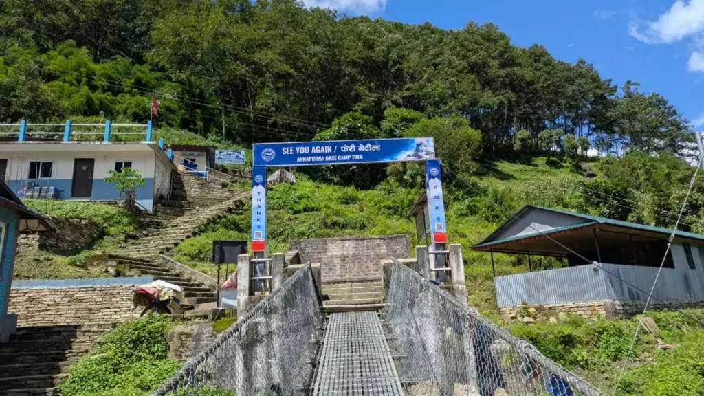
The ABC trek takes you into the Annapurna Sanctuary, a natural glacial amphitheater at roughly 4,130 m enclosed by Annapurna I, Annapurna South, Hiunchuli, and Machhapuchhre. Most itineraries start from Nayapul or Kimche near Pokhara, pass through Ghandruk or Chhomrong, and reach base camp in 5–7 days of walking before returning.
| Trekker’s Tip: Because the ascent from Chhomrong to ABC is gradual compared to routes with higher single-day elevation gains, altitude sickness is relatively uncommon on this trek, but it is not impossible above 3,600 m, so pace yourself on the final two days regardless of how fit you feel. |
2. Annapurna Circuit Trek
The Annapurna Circuit is the region’s signature long-distance trek, circling the entire Annapurna massif and crossing Thorong La Pass (5,416 m), the highest point most trekkers reach anywhere in Nepal outside a mountaineering expedition. Depending on the starting point and any side trips, such as Tilicho Lake, the trek covers roughly 130 to 230 km and takes 12 to 22 days.
Road construction over the past decade has shortened the trekking-only sections of the classic route, and many operators now combine walking with jeep transport on the lower Manang and lower Mustang sections to avoid road dust and traffic. A common modern variation starts around Chame or Koto, treks over Thorong La, and finishes with a short flight from Jomsom back to Pokhara, cutting the trip to roughly 10 to 12 days while still including the highlight sections.
Important: Since April 2023, solo trekking without a licensed guide has been prohibited in Nepal’s conservation and restricted areas, including Annapurna. As of the 2026 season, individual trekkers no longer need a minimum group of two people, but a licensed guide is still mandatory for all Annapurna treks.
3. Mardi Himal Trek
Mardi Himal is a shorter, steeper alternative that climbs a narrow ridge with close, dramatic views of Machhapuchhre’s south face. It sees far fewer trekkers than ABC or the Circuit, and it can be combined with a Poon Hill add-on for travelers wanting two classic viewpoints in one trip.
4. Khopra Ridge Trek
Khopra Ridge is a quieter route through Magar villages that reaches Khopra Danda (4,660 m), with panoramic views across the Annapurna and Dhaulagiri ranges and an optional side trip to Khayer Lake. It’s a good choice for trekkers who want ABC-level scenery with noticeably fewer people on the trail.
Annapurna Region Permits and Costs
Every trekker entering the Annapurna region needs a valid Annapurna Conservation Area Permit (ACAP). As of the 2026 season, ACAP is the only mandatory permit for standard Annapurna routes. The TIMS card, previously required alongside ACAP, is no longer enforced on Annapurna trails.
| Permit | Foreign Nationals | SAARC Nationals | Notes |
| ACAP (Annapurna Conservation Area Permit) | NPR 3,000 | NPR 1,000 | Required for all standard Annapurna treks; one permit covers multiple routes within the ACA during a single visit |
| Restricted Area Permit (Upper Mustang) | Higher fee, priced per day | Higher fee, priced per day | Only required if continuing beyond Kagbeni into Upper Mustang |
Children under 10 years old are exempt from the ACAP fee regardless of nationality. The permit can be obtained in person at Nepal Tourism Board offices in Kathmandu or Pokhara, or in advance through the NTNC’s online portal. Buying it at a trailhead checkpoint instead of in Kathmandu or Pokhara typically costs significantly more, so it’s worth arranging beforehand.
| Budget Tip: ACAP is a single-entry permit valid for all Annapurna-area routes during your trip, so if you are combining treks, for example, hiking Poon Hill on your way toward ABC, your existing permit covers the whole itinerary. You do not need to buy a new one for each trail. |
Permit Update: Regulations that took effect in March 2026 removed the previous requirement for restricted-area permits, such as Upper Mustang, to be booked by a minimum of two trekkers. Solo travelers can now obtain these permits individually, provided they are accompanied by a licensed guide booked through a registered trekking agency. Independent trekking without a guide remains prohibited.
How to Get to the Annapurna Region
Nearly every route into the Annapurna region starts in Pokhara, Nepal’s main gateway city for the region, located about 200 km west of Kathmandu.
By air: Regular domestic flights connect Kathmandu to Pokhara in about 25 minutes. This is the fastest option and the one most first-time visitors use.
By road: Tourist buses and private vehicles travel the Prithvi Highway between Kathmandu and Pokhara in roughly 6–8 hours, depending on traffic and road conditions.
From Pokhara to the trailhead: Depending on your chosen trek, you’ll continue by local bus, shared jeep, or private vehicle to trailheads such as Nayapul (for Ghandruk/Ghorepani/ABC), Kande (for Mardi Himal), or Besisahar/Chame (for the Annapurna Circuit).
| Local Insight: If your schedule is tight, flying Kathmandu to Pokhara and taking a jeep to the trailhead the same day is realistic for most routes. Doing the reverse, driving from Kathmandu directly to a trailhead, is possible but adds a long, winding day on mountain roads that many first-time visitors find more tiring than flying. |
Suggested Annapurna Region Itineraries
Because the region supports everything from a long weekend to a three-week expedition, here are three sample itineraries based on common time budgets.
| Days Available | Suggested Itinerary | What You’ll See |
| 4–5 days | Ghorepani–Poon Hill Trek | Sunrise mountain panorama, Gurung and Magar villages, rhododendron forest (spring) |
| 7–10 days | Annapurna Base Camp Trek | Full glacial amphitheater, Chhomrong, Machhapuchhre Base Camp, hot springs at Jhinu Danda |
| 12–16 days | Annapurna Circuit (Chame to Jomsom, with a Tilicho Lake side trip) | Thorong La Pass, Manang, Tilicho Lake, Muktinath, Kali Gandaki Gorge, Marpha |
| Quick Fact: Adding the Jhinu Danda hot springs to the end of an ABC itinerary is one of the most common and most appreciated small additions trekkers make. It is a short detour on the return leg and a welcome way to ease sore legs after days of descent. |
Accommodation in the Annapurna Region
The Annapurna region runs on a teahouse trekking system, meaning you don’t need to carry a tent, sleeping system, or cooking gear on any of the standard routes. Simple family-run lodges line every major trail, offering a private room (usually with twin beds and shared bathroom facilities at higher elevations) and a dining hall that doubles as the village’s social hub in the evening.
| Elevation Band | What to Expect |
| Below 2,500 m (Ghandruk, Chhomrong, lower circuit) | Attached bathrooms are often available, with hot showers and wider food menus |
| 2,500–3,800 m (Ghorepani, Manang, Muktinath) | Shared bathrooms are more common; hot showers are usually available for a small fee |
| Above 3,800 m (Thorong Phedi, High Camp, ABC) | Basic rooms, cold or bucket-hot water only, simpler food menus |
Most teahouses expect guests to eat dinner and breakfast at the lodge in exchange for a low or free room rate. This is standard practice, not an upsell, and it is part of how the teahouse economy sustains itself.
Food in the Annapurna Region
Trail food across the Annapurna region centers on dal bhat, lentil soup, rice, vegetable curry, and pickle, usually with a free second helping, which remains the most reliable, high-calorie option at every altitude. Menus also typically include noodle soups, fried rice, momos (dumplings), and basic pasta dishes, though variety narrows the higher you climb.
In Thakali villages like Marpha and Jomsom, look for Thakali thali, a regional variation of dal bhat known for its distinct spicing, and locally made apple products. Dried apple rings, apple brandy, and apple pie are all Marpha specialties worth trying.
| Trekker’s Tip: Prices for the same dish rise noticeably with elevation, since everything above the roadhead is carried in by a porter or mule. A plate of dal bhat that costs a few hundred rupees near Pokhara can cost two to three times as much at Thorong Phedi. Factor this into your daily budget rather than being surprised by it. |
Packing List for the Annapurna Region
What you need depends heavily on which trek and season you choose, but a few essentials apply across nearly every Annapurna route.
- Layered clothing: moisture-wicking base layer, insulating mid-layer, waterproof/windproof outer shell
- Insulated down jacket (essential above 3,000 m, useful even in autumn evenings)
- Sturdy, broken-in trekking boots
- Sleeping bag rated to at least -10°C for high-altitude routes like the Circuit or ABC
- Trekking poles (especially valuable on the steep stone stairways around Ghorepani and Chhomrong)
- Water purification tablets or a filter (bottled water is discouraged for plastic-waste reasons in the conservation area)
- Basic first-aid kit, including altitude sickness medication if prescribed by your doctor
- Headlamp, sun hat, sunglasses rated for high-altitude UV, and high-SPF sunscreen
Packing Tip: Temperatures above 3,500 m frequently drop below freezing after sunset, even during the clear, popular months of October and November. A -10°C or warmer down jacket and thermal base layers are not optional extras on the Circuit or ABC. They are the difference between an uncomfortable evening and a genuinely unsafe one if you are caught out later than planned.
Culture and People of the Annapurna Region
The Annapurna region is home to several distinct ethnic communities, each concentrated in different valleys along the trekking routes.
The Gurung people are prominent in the southern and central hills around Ghandruk and Ghorepani, historically linked to Gurkha military service and known for their Buddhist and animist traditions.
The Magar communities are found through the Khopra and Myagdi areas, with their own language and customs distinct from Gurung traditions.
Further north and west, in villages like Marpha, Jomsom, and Tukche, the Thakali people are known for their trading history along the Kali Gandaki salt route, distinctive architecture, and cuisine.
Respecting local customs matters throughout the region, this includes dressing modestly near temples and monasteries, asking before photographing people, and walking clockwise around mani walls and chortens, a Buddhist convention followed throughout the upper Annapurna villages.
Safety Tips and Altitude Sickness
Altitude sickness is the most significant safety concern in the Annapurna region, since several popular routes climb above 3,500 m, and the Circuit’s Thorong La Pass reaches 5,416 m. Symptoms of mild altitude sickness, including headache, nausea, fatigue, and disturbed sleep, can appear starting around 2,500 to 3,000 m and should never be ignored.
Safety Advice: The standard guidance for safe acclimatization is to avoid increasing your sleeping altitude by more than roughly 300 to 500 meters per day once above 3,000 m, and to build in a rest day for every 1,000 meters gained. If symptoms worsen rather than improve with rest, the only reliable treatment is descent, not pushing forward.
Other practical safety points:
- Travel with a licensed guide, which is now a legal requirement in conservation areas including Annapurna, and which also provides a safety resource if problems arise.
- Purchase travel insurance that explicitly covers high-altitude trekking and helicopter evacuation up to at least 6,000 m.
- Carry a basic first-aid kit and know the symptoms of High Altitude Pulmonary Edema (HAPE) and High Altitude Cerebral Edema (HACE), both of which require immediate descent and emergency evacuation.
- Check trail and pass conditions locally before attempting the Thorong La or the Tilicho Lake side trip, since both can close temporarily due to snow or landslide risk.
Annapurna Region Travel Costs
Trekking in the Annapurna region is inexpensive compared to most mountain destinations worldwide, though costs scale with altitude, trek length, and whether you book independently or through an agency.
| Expense | Estimated Cost (per person) |
| ACAP permit | NPR 3,000 (~US$22–25) |
| Teahouse accommodation | US$3–10/night (often discounted or free with meals) |
| Meals (dal bhat, tea, snacks) | US$15–30/day, rising with altitude |
| Licensed guide | US$25–35/day |
| Porter (optional) | US$20–25/day |
| Domestic flight (Kathmandu–Pokhara) | US$100–150 one-way |
| Budget Tip: Guide and porter costs are usually the largest variable in your total budget. Hiring one person as a combined guide-porter is a common way independent budget trekkers reduce costs on shorter routes like Poon Hill or Mardi Himal, though for longer, higher-altitude treks like the full Circuit, a dedicated guide focused on navigation and safety is worth the extra cost. |
Common Mistakes to Avoid in the Annapurna Region
- Skipping acclimatization days to save time is the single biggest cause of altitude sickness on the Circuit and ABC.
- Underestimating stone stairways. The descent from Ghorepani and the climb into Chhomrong involve thousands of stone steps that are harder on the knees than the elevation gain suggests.
- Buying permits at trailhead checkpoints instead of Kathmandu or Pokhara typically costs more.
- Packing insufficient warm layers because lower-elevation Pokhara feels mild. Temperatures swing dramatically once you climb above 3,000 m.
- Not budgeting for rising food and lodging costs at altitude can catch first-time trekkers off guard on longer routes.
- Assuming TIMS is still required. As of 2026, it is ACAP alone for standard Annapurna routes, though it is worth confirming current requirements before you travel since rules have changed in recent years.
Final Thoughts
The Annapurna region Nepal is known for rewards for almost every travel style, from a four-day sunrise hike to Poon Hill to a three-week circuit crossing Thorong La Pass.
What makes it stand apart is the sheer range packed into one protected area, including subtropical villages, alpine forest, sacred pilgrimage sites, and some of the most dramatic mountain scenery on Earth, all reachable through a single ACAP permit and a network of teahouses that make planning genuinely manageable.
If you are mapping out your own trip, start by matching your available time and fitness level to one of the routes above, then build outward from there. And if you want route-specific detail, our in-depth guides to the Annapurna Base Camp Trek, the Annapurna Circuit, and the Ghorepani–Poon Hill Trek go further into day-by-day planning for each.
Frequently Asked Questions
1. Is the Annapurna region good for beginners?
Yes. Routes like Ghorepani-Poon Hill and Ghandruk are well-suited to first-time trekkers, with shorter daily walking hours, teahouse accommodation, and a maximum altitude (3,210 m at Poon Hill) low enough that altitude sickness risk is minimal for most people.
2. Do I need a guide for Annapurna treks?
Yes. Since April 2023, solo trekking without a licensed guide has been banned in Nepal’s conservation areas, including Annapurna. This applies to all standard routes, including ABC, the Circuit, Poon Hill, and Mardi Himal.
3. How many days do I need for the Annapurna Circuit?
Most modern itineraries take 10-16 days, depending on your starting point and whether you add the Tilicho Lake side trip. The classical full circuit from Besisahar can take up to 20-22 days, though road access now shortens this for most trekkers.
4. What is the highest point on the Annapurna Circuit?
Thorong La Pass, at 5,416 m, is the highest point most trekkers reach in the Annapurna region.
5. Is Annapurna Base Camp harder than the Annapurna Circuit?
Generally no. ABC tops out at 4,130 m with a gradual ascent, while the Circuit reaches 5,416 m at Thorong La and covers significantly more distance, making it the more physically demanding of the two.
6. What permits do I need for the Annapurna region?
For standard routes (ABC, Circuit, Poon Hill, Mardi Himal, and Khopra Ridge), you need only the ACAP permit. If you continue into Upper Mustang beyond Kagbeni, you’ll also need a separate Restricted Area Permit.
7. When should I avoid trekking in the Annapurna region?
The monsoon months (June–September) bring the least reliable weather and visibility on the southern approaches, though Mustang’s rain-shadow trails remain relatively viable during this period.
8. Can I see the Annapurna range without trekking?
Yes. Pokhara itself offers clear views of the Annapurna range on good-weather days, and short day trips to villages like Ghandruk or a Poon Hill sunrise hike are accessible without a multi-week commitment.
9. Is altitude sickness common in the Annapurna region?
It’s a real risk above roughly 3,000 m, particularly on the Circuit near Thorong La and on the Tilicho Lake side trip, but it’s largely preventable with proper acclimatization pacing and is uncommon on shorter, lower-elevation routes like Poon Hill.
10. What wildlife might I see in the Annapurna Conservation Area?
The ACA is home to snow leopards, Himalayan black bears, musk deer, and numerous bird species, though snow leopards in particular are rarely seen due to their elusive, high-altitude habitat.
11. Is Wi-Fi or a phone signal available on Annapurna treks?
Most teahouses on popular routes offer paid Wi-Fi or local SIM connectivity at lower and mid elevations, though coverage becomes less reliable above 4,000 m, particularly around Thorong Phedi and High Camp.
12. Can families or children trek in the Annapurna region?
Shorter, lower-altitude routes like Ghandruk or the lower stages of Poon Hill can work for families with older children, though high-altitude routes like the Circuit or Tilicho Lake are generally not recommended for young children due to altitude risk.
Sources
Onlinekhabar: The Annapurna area welcomes visitors from 169 countries in the last fiscal year